Into Queensland
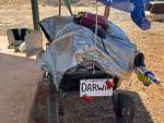
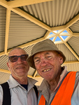
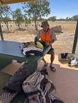
From Barkly Roadhouse this morning the road (which is called the Barkly Highway) heads towards the border with Queensland and the town of Camooweal. Along the way there are a few rest areas which I remember from our last trip to this part of the world. At the last of these rest areas about 60km from Camooweal I met a guy named Norm who was on an expedition to walk from Townsville to Darwin. He is carrying his survival gear in a modified garden troller.
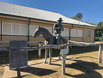
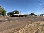
The town of Camooweal has a mounted stockman as a monument to those that fought for Australia in WWI and WWII. I included a photo of the local pub (which I think is closed) and the community center.
A number of times on this trip I have seen large clouds of dust in the distance. I eventually worked out that such clouds are caused by road trains driving on unsealed (gravel) roads. On this days ride I actually caught such a roadtrain while I had time to take a photo.
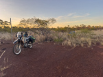
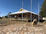
I spent the night in a wide cleared area at the entrance to a farming property. The location is marked by a sign Split Rock. I dont understand the meaning of the sign.
Unfortunately the night was somewhat uncomfortable as my sleeping mat developed a leak the night I camped at the north end of the Tablelands Highway and so tonight I tried to improvise some padding from my clothes.