Island of 1000 Volcanoes
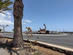
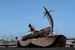
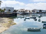
This morning we docked in the city of Arrecife which is the capital of the Island of Lanzarote. Lanzarote is the most northern island of the Canary Islands, which is Spanish territory and therefore part of Europe. Boy that was a mouth full.
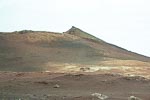
Today our excursion was another bus tour and this time focused largely on Timanfaya National Park and the volcanic nature of this island, which is coloquially known as the island of 1000 volcanoes but if you google the island you will find that it has only 200 to 300 volcanoes; still pretty impressive for an island that measures 60km north to south and 25km east to west at its widest point. Between 1730 and 1736 the island experienced a major series of volcanic eruptions which lasted 2053 days, created 30 new volcanic peaks, and formed the Montanas del Fuego (Fire Mountains) in todays Timanfaya National Park.
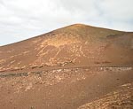
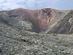
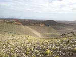
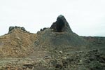
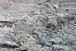
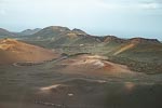
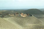
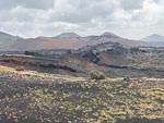
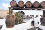
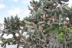
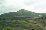
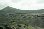
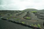
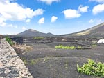
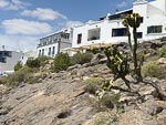
As you can see from the photos above the volcanic nature of the island dominates all aspects of life, as the volcanic soil contains no ground water such as river or creeks, and much of the arrable soil is covered by volcanic ash blown around by prevailing winds. However some of the early settlers to the island noticed that underneath the top layer of volcanic rocks the sub layers were wet, as a result of dew settling on and flowing through the top layers. That observation gave rise to the following farming practices.
The first is to cover fields of bare soil with a shallow layer of crushed volcanic rock so as to catch dew and deposit the moisture downward onto the soil. Unfortunately we did not get any good photos of this practice.
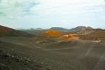
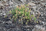
The second is demonstrated in the circular depressions seen in the photos these are made to provide access to the underlying soil which is necesssary so that the various agricultural plants can grow in soil rather than ash. The curved stone walls collect dew which filters down through the ash to nourish the plants.
This link will give some more info about Lanzarote